US energy giant Kinder Morgan’s plan to twin its existing Trans Mountain pipeline would result in over 400 tankers loaded with toxic tar sands oil travelling through the Salish Sea each year. If approved, this project would put the ecosystems, economies and people of the Salish Sea at greatly increased risk of a catastrophic oil spill.
If the oil spilled, where would it go?
 To
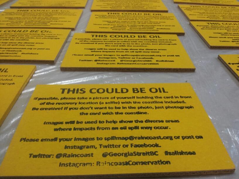
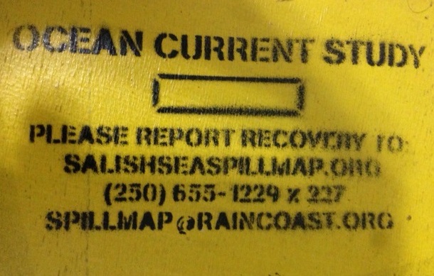
help answer this question, we are dropping over 1000 small drift cards
(4” x 6” pieces of bright yellow plywood, each with a unique serial
number) at locations of higher risk of incident along the oil tanker
route that runs from Burrard Inlet, through the Gulf and San Juan
Islands and out into the Strait of Juan de Fuca. Just like a message in a
bottle, the drift cards carry a simple message: this could be oil. When
the drift cards are found and reported to us (on this site), their
recovery locations will help us to map the paths oil spills might take,
and how far the oil could travel.
To
help answer this question, we are dropping over 1000 small drift cards
(4” x 6” pieces of bright yellow plywood, each with a unique serial
number) at locations of higher risk of incident along the oil tanker
route that runs from Burrard Inlet, through the Gulf and San Juan
Islands and out into the Strait of Juan de Fuca. Just like a message in a
bottle, the drift cards carry a simple message: this could be oil. When
the drift cards are found and reported to us (on this site), their
recovery locations will help us to map the paths oil spills might take,
and how far the oil could travel.While there are many differences between oil and drift cards, the cards are influenced by both surface ocean currents and wind, much like oil on water. By linking the drop sites to the locations where the cards are found, we will be able to broadly track the card movements, and highlight areas where they accumulate. The data collected will therefore also inform our understanding of which communities, recreational sites, species and habitats could be affected in the event of a spill.
- Read our preliminary results report (December 2013)
- Find out more about the science behind the project.
Link to Spill Map
No comments:
Post a Comment